We recommend viewing this page on a desktop pc or tablet for a better viewing experience.
SOUTH LYNN BRIDGES & HARBOUR JUNCTION
Welcome to my page focusing on South Lynn & Harbour Junction at King's Lynn in Norfolk. Harbour Junction was located just outside of King's Lynn on the Lynn to Ely main fen line. In its early days, the Lynn Sutton Bridge railway left the fen line at Harbour Junction and headed towards its next station at West Lynn. However, West Lynn had a very short life, operating only from 1866 to 1886. In 1886, with the closure of West Lynn, South Lynn station opened with the construction of the Lynn avoiding line. This line was constructed to link the Sutton Bridge railway with the Lynn Fakenham railway, diverting traffic from the busy main station at King's Lynn with a new station constructed on the southern side of the town. Once the Lynn avoiding line was built, the short piece of track between Harbour Junction and South Lynn was used as a shuttle junction to take trains from South Lynn station, which became the M&GN, into King’s Lynn's main station. Many services that used this shuttle line from the M&GN went on towards Hunstanton as summer holiday specials. It was also noted that when the M&GN closed down in 1959, traffic towards Hunstanton for summer specials dramatically slowed down, contributing to the closure of the Hunstanton line. Over time, many sidings were added to various industrial units at South Lynn, especially the beet factory, which remained operational until the mid-90s. On the opposite end of the Harbour junction, there used to be a brief freight line that connected to the South Quay in Kings Lynn. Sadly, this railway was shut down back in 1968.
A page dedicated to this line can also be found on this website.
In later years, the M&GN shut down in 1959, but the junction continued to operate for freight transportation to the South Lynn beet factory.
Near Harbour Junction, towards King's Lynn, there was another junction for the now-closed Campbell's soup factory. Some points remain on the track bed, which can be observed while travelling on the A47. However, it is not possible to access them on foot, so please don't try to capture photographs of these inaccessible points. I believe Campbell's factory shut down in 2007 at what time the railway ceased operations. I'm uncertain if you possess any information on this matter. Kindly reach out to me. It has since been suggested by Lewis Collard that Campbell's sidings may have closed back in 1991, coinciding with the end of Speedlink services. Thank you, Lewis, for this valuable information.
Near the harbour junction, there was a signal box that controlled the junction that housed a 36-frame system.
When I came across Lewis Collard’s page about the bridges and signals left behind in June 2020, I knew I had to check out this place. During my first visit, I took some pics of the bridges, but I didn’t know about the old buttresses from the M&GN. So, I went back in February 2023 to find the old buttress that used to cross the Lynn and Ely line.
After finding it, I thought there might be a signal there too. Thanks to the South Lynn M&GN Railway Heritage Group on Facebook, I found the old signal on Good Friday in 2023. Over the Easter weekend of the same year, I went back to the site and found some old signal parts and some of the original track still there.
Once again in February 2025 I revisited the site with a drone I had just purchased and managed to take some aerial shots of the site.
This page keeps growing and growing and I’m sure one day I will finish it or will I stumble upon something else ???
Please feel free to click the link below for a page dedicated to the Harbour branch railway.
I want to express my gratitude to these pages and their owners for the valuable assistance they provided in creating this page.
Wikimedia commons Harbour junction & South Lynn page
My Google Maps.
Google Maps link
HARBOUR JUNCTION HISTORICAL MAPS
This map depicts the track bed before the construction of the Lynn avoiding line. It diverted the Lynn Sutton Bridge line off from the Lynn Ely line & towards Sutton Bridge. Later on, this track bed was repurposed as a shuttle line for services from the M&GN. The map also indicates the location of the old signal box.
A more modern map looking at the Harbour Junction dated from 1944 to 1973 with South Lynn and the tracks running to industrial units.
"The maps used have been sourced from ©The National Library of Scotland. We extend our sincere thanks to them for their generous contribution."
PRESENT DAY MAPS
50/50 PAST & PRESENT MAP
"The maps used have been sourced from ©The National Library of Scotland. We extend our sincere thanks to them for their generous contribution."
Campbells siding
Just past the Harbour junction, there was a siding for the Campbell's soup factory. The factory has now completely disappeared, leaving only a small section of track off the Lynn Ely line near Harbour Junction.
A commercial park built on the factory site has been named Campbell’s Meadow in memory of Campbells factory.
"The maps used have been sourced from ©The National Library of Scotland. We extend our sincere thanks to them for their generous contribution."
©Year and photographer unknown
Harbour Junction
I would like to express my sincere gratitude to Tony Watson for permitting me to include his photographs on this website through the Midland & Great Northern Joint Railway M&GN Facebook page.
I am deeply appreciative of Tony’s generous sharing of these images of Harbour Junction with me.
Kindly refrain from reusing these photographs, as I have obtained explicit permission for their use.
Harbour Junction track Layout from the signal box.
Thanks to Tony Watson
A Cambridge to King’s Lynn Class 47 service passes by Harbour junction signal box.
Thanks to Tony Watson
Harbour Junction layout (early 1980’s)
On the left side of this photo, you can see the Harbour line to King's Lynn Quay, which was partially operational for freight traffic until the 1980s and closed in 1968 to the South Quay. Additionally, a semaphore signal is visible in the picture, which stands today in King's Lynn (Seen further down the page). On the right side of the photo, there is a small siding and a line that previously served the now-defunct Campbell's factory at King's Lynn. Some parts of the points still exist off the main line. Furthermore, the line is still doubled in this picture. However, it is now single-tracked after the electrification of the main line from King's Lynn to Cambridge.
Thanks to Tony Watson
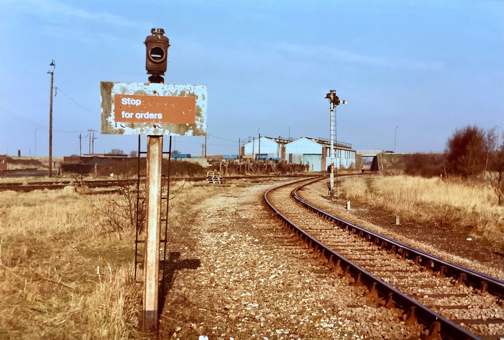
In the early 1980s, Tony Watson took a photo of the old signal at Harbour Junction, which was off the South Lynn Branch. That signal was replaced with a modern one that’s no longer in use.
Some parts of the modern signal were still visible during our visit in 2023.
You can check out a picture of what was left of the newer signal and maybe even the base from this old signal on this website.
Thanks to Tony Watson
South Lynn Branch looking towards Harbour Junction (early 1980’s)
Thanks to Tony Watson
Class 37 at Harbour junction
A Class 37 freight service passes the Harbour junction signal box.The Class 37 looked to be carrying silica sand, so I was guessing it was a service from Middleton Towers quarry.
Middleton Towers freight trains use the old King's Lynn to Dereham line that remained open as far as Middleton Towers for freight use and is still used to this day when this page was published in 2023
I have since kindly been told that this service would be carrying limestone for the sugar beet factory; many thanks for the information, Tony Watson.
I found this picture with the help of the King's Lynn and area Model by J T Colquhoun's Facebook page.
Thanks to Mark Brammer for the use of this photo.
Harbour junction area drone footage 2025
Aerial imagery of the former location of the Harbour Junction in 2025
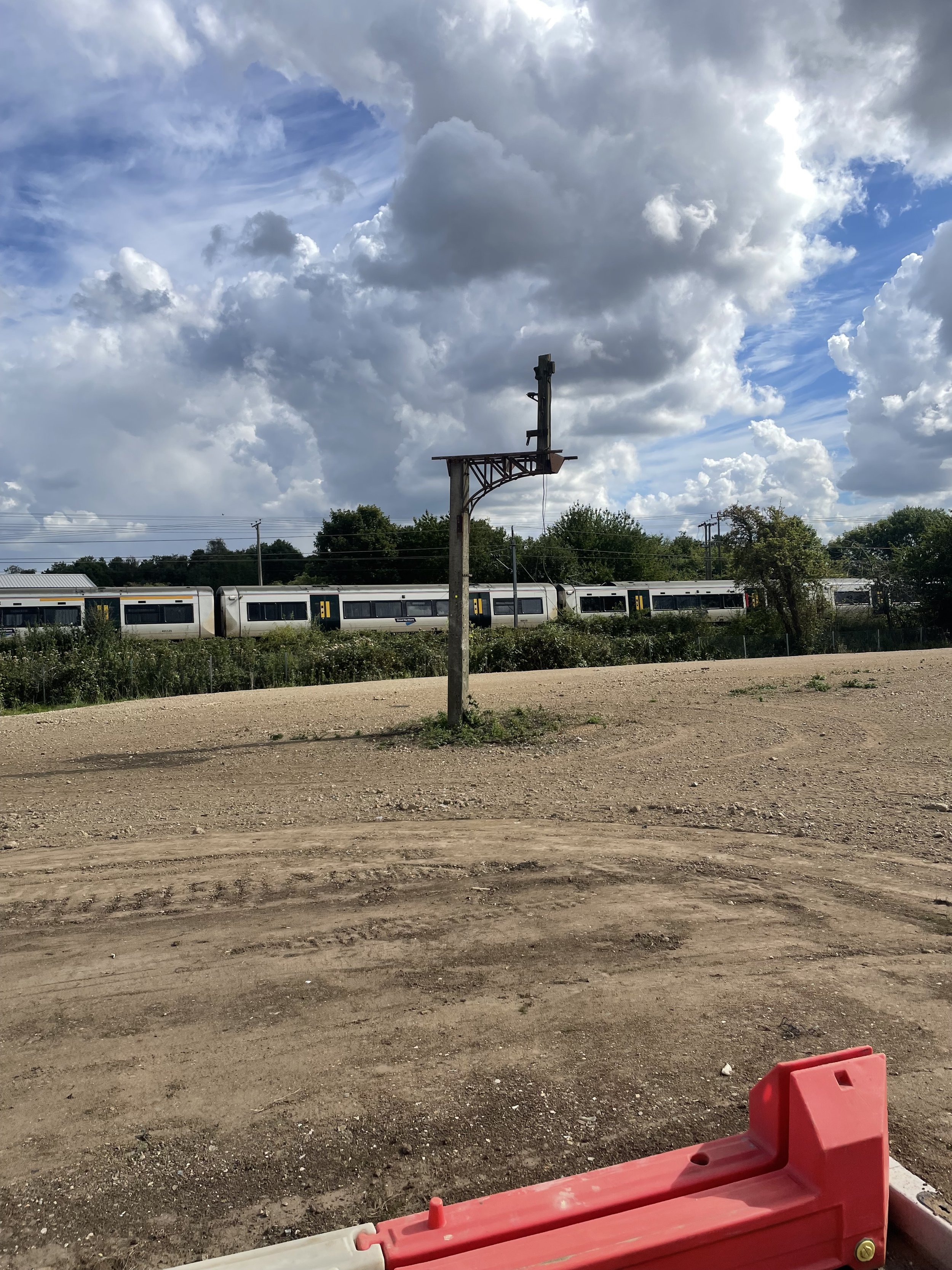
The Harbour branch semaphore signal.
This semaphore signal was at the start of the King’s Lynn Harbour railway that went to the South Quay that opened in 1849 and closed in 1968 up to Wisbech Road, and I have been told that the line for freight remained in place until the 1980s
Thanks to South Lynn M&GN Heritage Group this signal is expected to remain as it stands on Council land and will hopefully be turned into a historical railway monument.
Thanks to Tony Watson we can see a Photograph of when this signal was in use Tony tells us in his comments
“The signal Originally had two signal arms, this was its final guise with one arm in the late 70’s early 80’s.”
Thanks to ©Tony Watson
During my first visit to South Lynn in June 2020, I took these photos of the Semaphore signal. The signal still stands and was surrounded by a fence in 2020.
The site where this signal sits is now being turned into a medical centre.
In 2024, I revisited the site where the old signal still sits in the Nar Valley to see that the signal is still in place and has hopefully been kept as a memorial.
In 2024, I revisited the site where the old signal still sits in the Nar Valley to see that the signal is still in place and has hopefully been kept as a memorial.
M&GN Bridge PMY2-53
This bridge was built for the Lynn Avoiding Line was opened in 1885. It was used for freight use at first and then passenger traffic from 1886 onwards. The bridge then became part of the M&GN line, connecting South Lynn to Fakenham. The line extended to various other destinations in Norfolk, including Great Yarmouth, Sheringham, Cromer, and Norwich, all passing through Melton Constable.
The M&GN closed in 1959, and part of the line as far as East Rudham ran until 1967 for freight use;
I first visited this bridge in June 2020 and revisited here in February 2023 to get the buttresses left not far after this bridge and where the M&GN crossed over the Lynn Ely line.
I then revisited again in February 2025 for some drone shots.
In February 2023, I revisited this site and rephotographed this bridge.
Close to the M&GN bridge, I also found these spigot mortar mounts sitting just beside the bridge.
2025 Drone revisit
The M&GN Flyover bridge
The M&GN railway used to cross over the Lynn Ely railway line at South Lynn utilizing a bridge that carried the M&GN over the top. Today, all that remains is a buttress that was once part of a farm crossing just before the main bridge crossing that went over the Lynn Ely line. When visiting the area in 2023, we found that the only remaining structures are bridge PMY2-53 part of the old embankment and this buttress. The main crossover bridge at South Lynn was demolished many years ago, long before the electrification of the Lynn-Ely line.
The Buttress was originally constructed as part of the Lynn avoiding line, which was built between South Lynn and Bawsey. This line was intended to divert the Lynn Fakenham Railway away from King’s Lynn and towards Sutton Bridge to reduce traffic at the main King’s Lynn town station.
Also, I found a disused plate layer close to the buttress hut for the Lynn Ely line.
50/50 Modern and historical maps showing the M&GN bridge and Buttress.
The pointer seen below shows where the buttress supported the railway bridge that crossed over the farm crossing before crossing over the Lynn Ely line.
The old M&GN track bed shortly after the PMY2-53 bridge.
The remaining buttress at South Lynn once carried the M&GN over a farm access track and then over the Lynn Ely line.
This is where the M&GN would have once run many years ago. However, when I visited in 2023, this Industrial estate now takes its place.
2025 Drone revisit
I revisited this site in 2025 with a newly purchased drone and noticed that the area had become more overgrown, making it more challenging to reach the old buttress.
Here in 2025, we see where the old raised track bed would have once been the approach for South Lynn station.
Disused plate layers hut
This disused plate layers' hut is located by the main line, near the M&GN bridge. It was likely used by the Lynn Ely railway.
In 2025, I returned with a drone and captured another photograph of this dilapidated platelayers hut.
South Lynn Link Bridge & the Lynn Sutton bridge railway bridge.
This bridge had many different uses throughout its life.
When it first opened, it was used by the Lynn and Sutton Bridge railway. It took trains from King’s Lynn to Sutton Bridge, passing through a short-lived station called West Lynn. After the Lynn Avoiding line was built, the bridge became part of a shuttle line that took trains from South Lynn to King’s Lynn’s main station. In the summer months, many trains would also go towards Hunstanton from the M&GN.
The bridge could also take traffic from the M&GN towards the King’s Lynn Docks and the Harbour Railway line at the South Quay. It could also take traffic from the King’s Lynn to Dereham and Norwich Railway line.
In its last days, the old bridge was used as a shuttle line from the old British sugar factory, which has now been demolished. The sugar beet factory stood roughly where Palm paper now stands.
You can see the start of this junction when you cross over the railway on the A47. You can also see where the points once sat, as small parts of them remain on the track bed next to the central Lynn, Ely line. When the line was double-lined, the points were sited on the removed track.
This, to me, was one of the most exciting bridges I discovered with lots of help from disused railway fans, whom I can’t thank enough.
At first, in June 2020, this was the first bridge I visited and photographed as it was at the start of the Nar Valley walk.
King’s Lynn Link Bridge photographed in June 2020
©The national library of Scotland
The King’s Lynn Link Bridge Photographed in 2020
South Lynn Link Bridge revisited in February 2023
I revisited this site in 2023 to find the Buttresses I missed when I first visited in 2020 and rephotographed this bridge
Railway signs photographed in 2025
2025 Drone Revisit
South Lynn Link line track bed and signal
I once again revisited this section of the South Lynn railway line that linked up the M&GN and the Lynn, Ely line at South Lynn, knowing that once a long time ago, thanks to Lewis collards great page, there was an old part of a signal left behind in the overgrowth and thinking it was so overgrown there would be no access and thanks to other railway explorers once again this signal was to be found once more.
So over the Easter weekend of 2023, I went off again to South Lynn.
This is Network railway land and is best not tried to be reached as when we visited, we were under the assumption that it was not Network railway land.
Random parts from the old South Lynn Railway
We found this old remain close to where the signal stands, still determining what it could have been.
If anybody has any ideas, please contact me.
Could this be part of the old Semaphore signal?
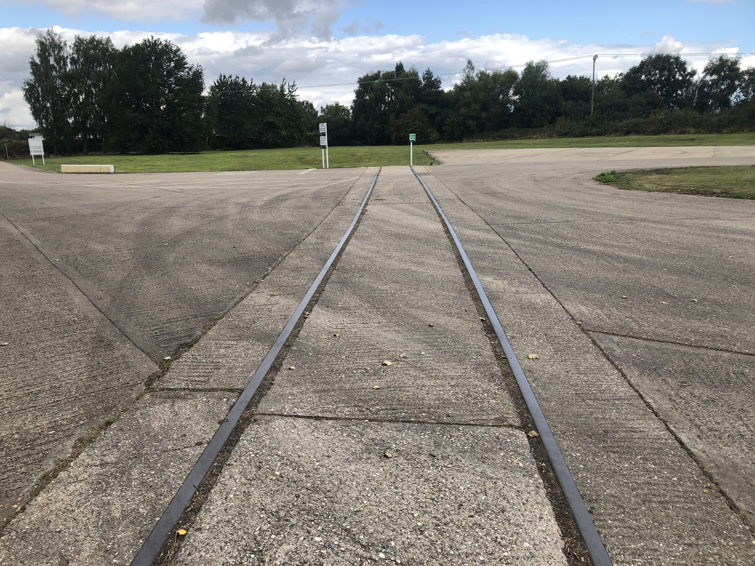
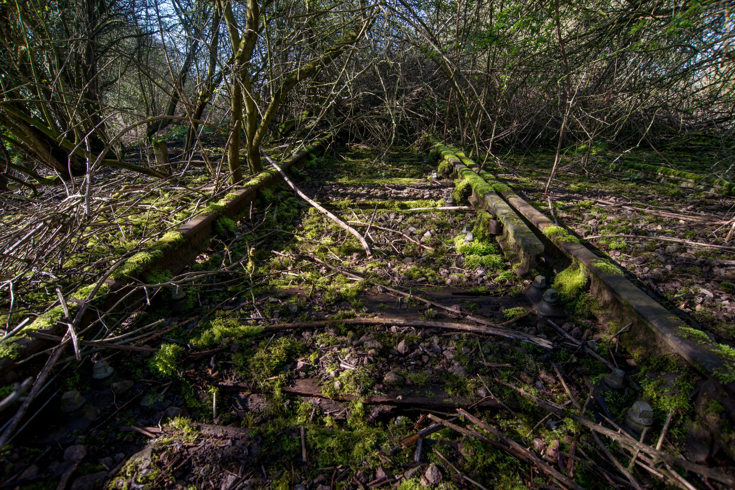
South Lynn Track Bed and Tracks
A fragment of the track remains near the Lynn Ely fen line.
This small section of track was once the bed of the Lynn Sutton bridge line and the M&GN link line.
Using Google Maps, it is evident that the end of this railway track is visible when crossing the A47 bridge near the Saddlebow entrance in King’s Lynn.
I did not venture too far to locate the railway’s termination point, as it was situated close to the main line fence.
Drone footage of the old track bed in 2025
Drone footage captures the tree line where the old track is now hidden beneath the over growth.
Harbour junction Line Side Hut
We stumbled upon an abandoned hut near the old track, hidden among the overgrown vegetation.
This old line side hut-plate layers hut was sited close to the semaphore signal on the South Lynn branch.
(Not the Semaphore signal off the Harbour branch)
In the 1980s, a freight train carrying Campbell’s soup was seen on the South Lynn branch. It was headed towards the soup factory located at the Hardwick Industrial Estate. This train would have entered the main King's Lynn to Cambridge line and would have crossed over the main line at a junction leading to the Soup factory just ahead.
Thanks once again ©Tony Watson
©Tony Watson
During our visit in 2023, we came across the remains of an old line-side hut near the main line. However, we refrained from exploring any further as it would have required us to get too close to the main line fence.
Drone footage of the old side line hut in 2025
When revisiting in 2025, I could spot the top of the old line side hut covered in overgrowth. The area appears heavily overgrown and not advisable to enter on foot.
The Second South Lynn signal.
We found this old signal in the overgrowth close to the Line side hut and relatively close to the main line.
We never went further than where this signal was as it was getting too close to the main line fence.
This signal was left behind from the closure of the Harbour junction line that linked up the M&GN to the Lynn, Ely main line, and this signal would have been installed long after the closure of the M&GN as back in those days, a semaphore signal would have controlled train coming on and off the M&GN.
(Pictures of the semaphore signal have recently been soused and can be seen at the top of this web page)
This newer signal would have been used in the lines in later days controlling freight trains for the sugar beet factory at the Saddlebow industrial estate.
Sadly, all that remains is the signal pole, the ladder, and some wire and. also we found an old bulb cover and maybe one of the bulbs from the old signal.
The signal box itself has gone.
In this first picture, you can make out the signal next to the track; in this picture, you can see how overgrown some parts are.
The second South Lynn Signal.
This would have been where the signal was once attached many years back before the signal, one way or another, disappeared.
All that remained in early 2023 was this wire showing where the signal once was.
We found these parts of the old signal in the overgrowth.
Possible Signal base or bridge support?
Not too far from the signal, closer to the bridge side of the track bed, we found this old brick support down the railway track bed bank.
What was it used for?
Maybe the old supports from the semaphore signal.
Looking at historical maps this is most likely part of an old support for a bridge.
If anybody knows, please feel free to reach out to me..
Around South Lynn.
Thanks to Tony Watson
South Lynn station
South Lynn Station was the second railway station in King's Lynn, located on the south side of the town. It was used by the M&GN railway for transportation to Sutton Bridge and Melton Constable. South Lynn was connected to the King's Lynn to Cambridge line via a shuttle line that linked up to the Harbour junction crossing the bridge seen above.
South Lynn station was opened in 1866 and served the surrounding area until its closure in 1959. Although the station itself has been demolished and no longer exists, freight movements continued to the beet factory and other nearby industrial units after its closure for a while after.
©National Library of Scotland.
©National Library of Scotland.
©National Library of Scotland.
The Free Bridge, Railway Bridge and South Lynn Station, King's Lynn, from the north-west, 1932 © Historic England. Aerofilms Collection EPW039193 flown July 1932
Please click on the aerial image for the Source page.
Year and photographer unknown.
Year and photographer unknown.
South Lynn site 2025
A drone shot taken in May 2025 shows the old site of South Lynn station. As we can see below, there is no trace of what once was South Lynn Station..
Once again, Thanks to Tony Watson for donating these pictures from the South Lynn area from when the railway was in use for freight use.
It appears that these are the remains of an old turntable located in South Lynn.
Thanks to Tony Watson
At South Lynn, there are freight wagons that appear to be carrying coal.
Thanks to Tony Watson
**Redundant Railway Buildings at South Lynn**
In the background, you can see the old works that are now used as the BT buildings, which are still standing today.
Modern pictures of the old railway works shed, now used by BT, can be seen further down this webpage.
Thanks to Tony Watson
Close to the Saddle-bow bridge that carries the road over the railway, one can see the South Lynn stop sign and engine sheds. The bridge was constructed after the closure of the M&GN.
The bridge remains to this day and pictures follow below.
Thanks to Tony Watson
The Saddlebow road railway bridge
This modern bridge was built long after the M&GN closed and the A47 was opened and was used to take Saddlebow road traffic over the old railway line that was used as far as the Sugar Beet factory.
In the distance in this first picture you can see palm paper this is where the old beet factory once roughly sat and close by was the old site of South Lynn station.
In the railway's final days, the track viewed from the Saddlebow Bridge displays the last remaining track used by the beet factory.
Attribution: Paul Miller-Wikimedia
After the remaining railway track had been removed
Attribution: Paul Miller-Wikimedia
The track bed viewed the other side of the railway bridge facing towards the Harbour Junction.
Attribution: Paul Miller-Wikimedia
Thanks to Paul Miller for the above photos; please visit his page for more excellent railway photography...
Paul Millers Wikimedia page
Railway tracks at South Lynn
These two pictures of some old railway track left behind were found at the now grain silo site on the Saddlebow industrial estate and were most likely left behind from what looks like some sidings from the M&gn at South Lynn.
At first, I thought they were from the sugar beet factory, but looking at old maps, the factory was far from where the sidings were.
Until I went onsite to the silos, I never knew these railway tracks were there, so it was a nice pleasant surprise.
These pictures were taken in August 2020; I’m unsure if they remain or have been covered.
We owe thanks to Lewis Collard once again for uncovering that these tracks were formerly used as sidings for Fen Grain company.
50/50 maps showing the modern and historical maps of the grain silos and also showing where the M&gn sidings ran years back.
Later dated maps showing the sidings running through the grain store.
Google map position of the old tracks
"The old tracks left behind from the South Lynn Railway."
King's Lynn Sugar Beet Factory
The King’s Lynn sugar beet railway was connected to the main railway via Harbour Junction and had a west-facing connection close to West Lynn station until the closure of South Lynn. The Lynn sugar beet factory railway opened in 1927 and ceased use in 1993, although beet traffic had already stopped in 1965. Later movements included outward goods such as sugar, pulp, and molasses, and inward goods including machinery, coal, coke, limestone, and beet.
The line closed in 1993, and the track was lifted in 1994, the same year the factory closed. To this day, nothing remains of the beet factory, and any small remains were demolished during the construction of Palm Paper.
Thanks to Norfolk Heritage Explorer for the historical information.
Historical maps showing the beet factory railway.
Thanks to the national. library of Scotland for the maps used.
Later dated historical map from the beet factory after the M&GN had closed, as the River Ouse bridge has disappeared, showing the access to the beet factory line heading in from the west end. This meant that services in the later days had to reverse into the factory site.
60/40 map coverage of the old beet factory is shown on historical maps, and palm paper is shown on modern maps.
Historical aerial images show the sugar beet factory and also the railway.
Thank you to Historic England for providing the aerial photo. Please click on the photo for its source page.
Thank you to Historic England for providing the aerial photo. Please click on the photo for its source page.
Palm paper drone footage taken May 2025
Railway shed at South Lynn
In 2024, I discovered new historical maps at the National Library of Scotland that confirmed my long-held suspicion about a railway-related building at South Lynn. It was initially used as a storage shed, possibly for the M&GN in its early days, and later for either the cold store, as indicated on the historic maps, or for Cooper Roller Bearings, who also appeared to have their dedicated siding. When these maps were created, the M&GN River Ouse bridge had been dismantled, and the M&GN line was closed. However, in the aerial image, the building is shown without the other industrial units in place at that time and was solely used by the railway.
To this day, the building is located just outside a haulage yard in South Lynn and appears to possibly still be used for storage, with both railway access doors bricked up.
Historic maps show the once railway-used warehouse.
Past & present map coverage.
Map coverage of South Lynn showing the warehouse and cold store, with the M&GN railway shown as closed and the river bridge dismantled.
Map coverage of the private railway sidings next door to the warehouse that is now Cooper Roller Bearings and possibly was cooper’s when these maps were produced as Cooper Bearings was established in 1894
"The maps used have been sourced from The National Library of Scotland. We extend our sincere thanks to them for their generous contribution."
Google map position of the old shed.
The old warehouse whilst still in railway use.
Thank you to Historic England for providing the aerial photo. Please click on the photo for its source page.
The warehouse in 2024.
The front of the old warehouse also showed another access door, allowing the railway to run right through this historic building.
©National library of scotland
Railway repair works at South Lynn
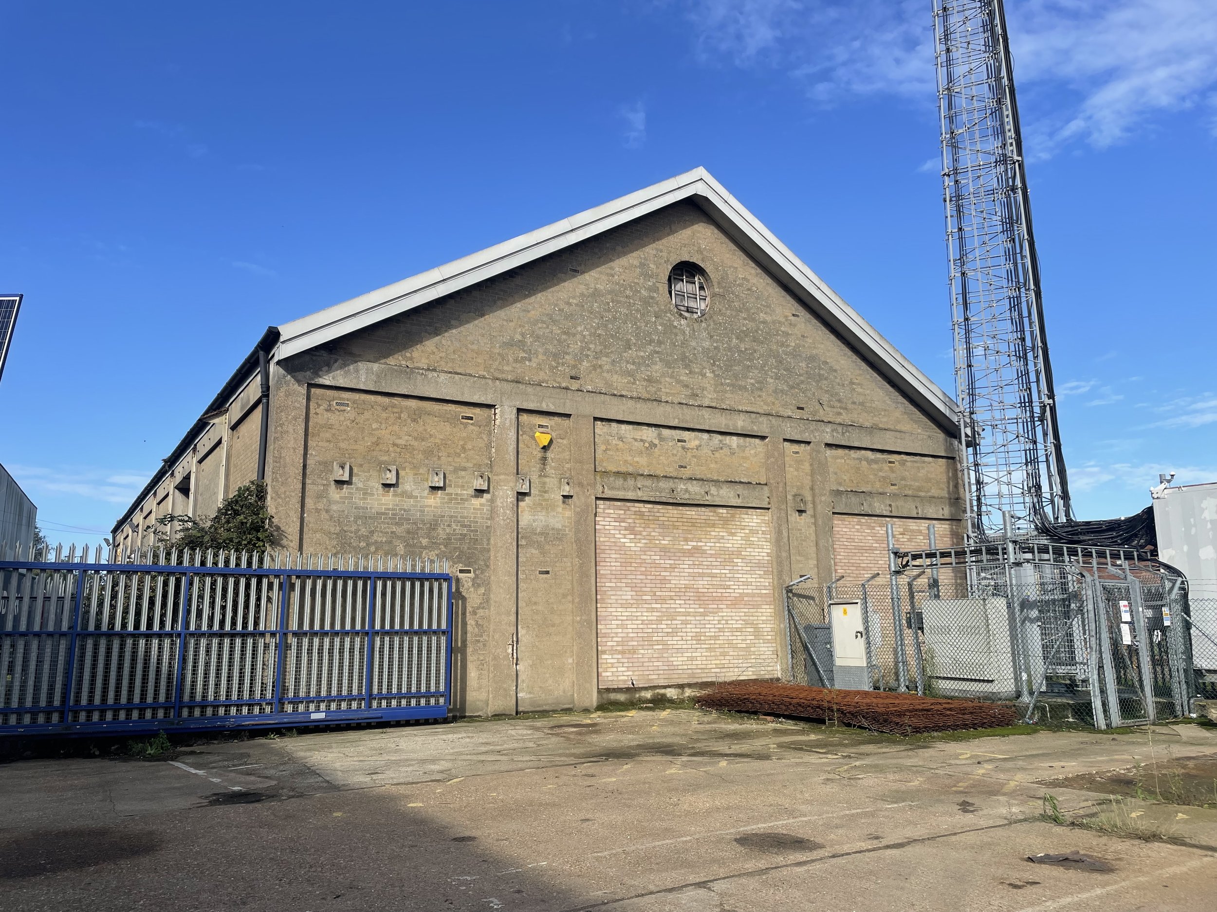
In 2024, I discovered new historical maps at the National Library of Scotland that confirmed my long-held suspicion about another railway-related building at South Lynn. According to these maps, the building was used for repair work and is situated close to the A47, currently occupied by British Telecom.
I do not know the construction date of this building, as there is little historical information available. Notably, a historic aerial photograph from 1932 does not show this building, suggesting it was not present at that time.
So far, the only photo I have taken of this building shows one edge of the old structure, which is covered with cladding. Both sides remain unclad, revealing original brickwork that is now overgrown on one side. The front of the building is located on private land, so I am unsure if there are any remaining access doors or if they have been bricked up—similar to the storage shed mentioned in the article above. It appears that the front of the building has also been clad over with further investigation.
During my visit to the site a few years ago, we noticed what appeared to be old M&GN-style lights on one side of the building as seen from the main high road, along with remnants of a platform, as indicated by the historical maps.
Historic maps reveal the locations of former railway works.
60/40 Past & present map coverage.
"The maps used have been sourced from The National Library of Scotland. We extend our sincere thanks to them for their generous contribution."
Google map position of the old works shed.
The old works shed in 2024
Various parts.
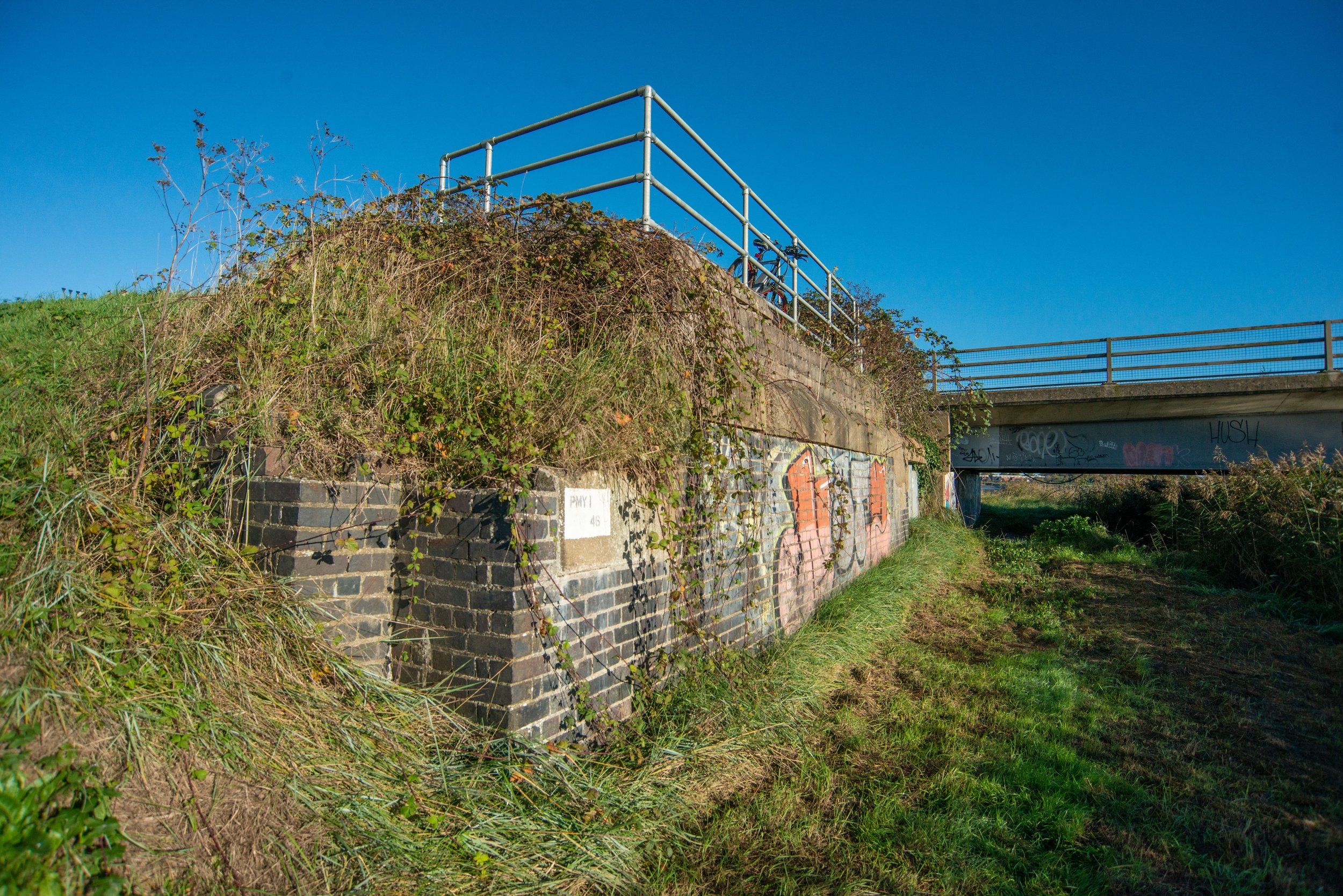
Bridge PMY 1-46
While driving through South Lynn, I stumbled upon a railway bridge code etched on a buttress near the former location of the South Lynn Station, although quite far from the alignment of the former railway.
PMY Bridge Codes stand for and are all used on the M&GN Network
PMY Peterborough to Yarmouth
PMY 1 Peterborough to South Lynn
PMY 2 South Lynn to Yarmouth
The Cut Bridge, also known as the Marshland Freebridge, was initially constructed for road traffic, not railway traffic. The buttresses on both sides are still visible, with the railway Bridge code painted on the West Side. The bridge was supported by iron concrete supports, which can still be seen today from the A47 and the Clenchwarton-Wisbech road.
The latter road bridge was built alongside the old road, crossing over the Ouse.
So why is there a railway marking on a road crossing??
Some ideas suggest the bridge was built a long time ago to provide access to the railway from West Lynn. However, information on this topic is limited. According to a website, the railways historically owned the piers of the old bridge.
Thank you once again to Lewis Collard for sharing the link mentioned.
Please click the link below.
If you have any ideas, please email or contact me via social media.
Historic maps dated 1798-1978
The historic map seen below shows the Marshland free bridge.
When these maps were drawn up, the railways in King’s Lynn did not exist.
©National Library of Scotland
Historic maps from the National Library of Scotland show the Free Bridge, Cut Bridge and the M&GN South Lynn railway bridge, which used to cross the River Ouse.
©The National Library of Scotland
50/50 map coverage showing the original road crossing and the newer crossing bridge still in use today, as well as the A47 Dual Carriageway bridge, roughly where the M&GN bridge that crossed the Great River once sat.
©The National Library of Scotland
Historic maps show the railway as dismantled and the posts from the old road bridge.
©The National Library of Scotland
The next historical picture below shows the Freebridge-Cut bridge and the M&GN railway crossing bridge with South Lynn station in the distance.
All the bridges in this photo no longer exist. The railway bridge has been replaced with the A47 Dual Carriageway, and the two road bridges have been demolished and replaced.
Thank you to Historic England for providing the aerial photo. Please click on the photo for its source page.
The railway code PMY 1-46 was found on the Buttress of the old Freebridge Road River Ouse crossing.
Does anyone know why a railway code was put on a road crossing?
The old Buttress from the Marshland Freebridge road crossing.
Captured in 2024, a bridge support remains from the old road crossing.
May 2025 drone visit.
On the opposite side of the river, there is a disused buttress. However, this side features a white-painted ID sign. Unlike the markings found on the other side of the river, this sign is completely plain and does not resemble the ID number PMY 1-46.
Possible loading bay at South Lynn.
Google maps position of the possible loading bay
Close to the bridges seen at the top of the page, we also found this concrete pad and some remains of this old brick wall.
Upon examining historical maps, it appears that there may have been an old building or pad located near the sidings of the former muck works at South Lynn, as depicted on maps dating from 1937 to 1961.
Any ideas???
Was this part of an old siding or a loading bay or possibly remains of an old building?
Please get in contact if you have any ideas.
Maps Dated 1937-1961 Thanks to the National Library of Scotland.
Looking at newer historical maps dated 19-44-1973 it shows this could be part of an old sports ground maybe later in its life or all along.
Thanks to Historic England, I found an aerial photo of the Muck works and the sidings from the old railway. However, I don't think the possible building or loading pad is shown in this photo.
Please click on the Aerial photo shown below for the source page.
Thank you to Historic England for providing the aerial photo. Please click on the photo for its source page.
What Remained when Photographed in 2023
"This bridge is not related to the railway."
Not far from the innovation centre lays this old bridge. This bridge is not railway related, but I have been told it was used for farm access many years back.
With the construction going on, I can't say how long this old piece of history has left.
Thank you
I am grateful to all those who have visited my website so far. Please do not hesitate to reach out to me with any information you may have or need.
I would like to extend a special thanks to Lewis Collard for his valuable input and his website, as well as to the South Lynn M&GN Railway Heritage Group on Facebook for their assistance and support.
Later in the life of this webpage, I would like to give a special thanks to Tony Watson for generously granting permission to use his photos of the Harbour Junction from the 1980s. Thank you so much!
I would like to thank Paul Miller for letting me use his photographs from his Wikimedia page.
Your contributions were instrumental in the creation of this page, and I am truly appreciative of your help.
All pictures on this page are downloadable for free from my Wikimedia page.
Please see the link in the footer


