Part One Norwich City to Drayton
Norwich city to Melton Constable
Marriotts way
Welcome to Norfolk's disused Railway's coverage from the M&gn line from
Norwich City to Melton Constable.
The Lynn & Fakenham Railway Act of 1880 authorized the construction of a railway line connecting Fakenham to Norwich via Melton Constable. Services commenced in January 1882.
The railway line extended from Norwich City to Hellesdon, Drayton, Attlebridge, Lenwade, Whitwell & Reepham, Guestwick, Hindolvestone, and Melton Constable.
Melton Constable was a crucial railway hub, and it was often referred to as the "Crewe of Norfolk." The engine works built there were incredibly vast. Passengers could travel to different destinations across Norfolk using the M&GN railway network from Melton Constable.
North Walsham, Cromer, Great Yarmouth, Fakenham, and South Lynn
(where the M&GN was connected to other M&GNJR lines from Sutton Bridge, Wisbech, and Peterborough)
For a dedicated page on Melton Constable, please click here
Norwich City station was one of three stations constructed in Norwich, the other two being Norwich Thorpe and Norwich Victoria.
Norwich City station was severely damaged in 1942 during World War II. Temporary concrete structures were erected after the war. Although the station was closed to passengers in 1959, it continued to be used for freight until 1969.
In May 1958, British Railways concluded that the M&GNJR was entirely loss-making. The railway was closed after the last trains ran on Saturday, 28 February 1959.
Part of the track between Lenwade and Themelthorpe remained down until the mid-80s for freight use from Lenwade Works.
The freight line passed through Whitwell & Reepham railway station has now been restored as a heritage site, and a page dedicated to this station can be found by clicking here
The Marriott's Way walk now incorporates some areas where this line once ran. The walk commences near the former site of Norwich City Station and follows the old M&GN track bed up to Themelthorpe. After Themelthorpe, the Marriott's Way walk continues along the track bed of the old Great Eastern Railway.
The Themelthorpe Curve was a railway track built to connect two separate railway lines in Norfolk, UK. It was one of the last stretches of railway track built by British Rail in the area and was known for having the sharpest curve on the entire British rail network, with a speed limit of 10mph. The track was inaugurated in 1960 to shorten the route taken by freight trains carrying concrete products from a terminal located in Lenwade. However, it was closed down in 1985.
The line today
After the closure of the M&gn as stated above part of the line remained for freight once all freight movments had ceased use the track was lifted and parts of the line were turned into a public foot and cycle path called Marriotts way.
Part of Norwich City Station's remains have been uncovered by volunteers from Friends of Norwich City Station, near the goods sheds. Much of the site has been converted into an industrial area. Hellesdon railway station was closed in 1952, and unfortunately, the station building was already demolished by the time volunteers cleared the site and platforms in 2018. Drayton station, along with several bridges, was demolished and replaced by housing and an industrial estate. On the other hand, Attlebridge railway station still remains and is currently used as a private residence. Lenwade railway station also survives as a private residence. Whitwell & Reepham railway station is now a Heritage railway site, while Guestwick railway station still survives and is also being used as a private residence. Similarly, Hindolvestone railway station still exists and is being used as a private residence. As for Melton Constable railway station and works, the station no longer remains and has been completely demolished. However, some parts of the works still remain and are currently being used as industrial units.
Marriotts way
Marriott’s way is a cycle and walking path owned by Norfolk council that runs along the old track bed from Norwich city as far as Themelthorpe where it joins the Great Eastern Railways track bed as far as Aylsham where the walk ends after some 26 miles.
The Norfolk County Council bought the trackbed of two railway lines in 1979 to create a path for pedestrians and cyclists. The first part of the path, which runs from Aylsham to Reepham, was opened in 1985. The other parts of the path were opened in stages over the following years. The final section, which runs from Drayton to Norwich, was opened in 1989.
The Marriot's Way walk starts at the roundabout of Barn Road and Barker Street inner-ring road located in the heart of Norwich. At the starting point of the route, you will notice the railway monument and the old railway gates. On March 29th, 2021, I took photos of the part between Norwich and Drayton. I parked at Drayton, cycled to Norwich, and captured the line's photos on my way back since Drayton was closer to my home. However, the distance from your location may vary, depending on where you live. It's worth noting that Norwich has more accessible parking options than Drayton, which has very few parking spaces.
Marriott's Way is named after William Marriott, who served as Chief Engineer and Manager of the Midland and Great Northern Railway (M&GN) for 41 years. The M&GN was a rural network that was often referred to as the "Muddle and Go Nowhere" line.
Google Maps coverage.
Norwich city to Melton Constable.
Coverage of all M&gn stations.
NORWICH CITY STATION
Norwich City station was a significant railway station in Norfolk which served as the southern terminus of the Midland and Great Northern Joint Railway (M&GN) line that ran from Melton Constable. The station began its operation in 1882 and had four platforms, an engine shed, two signal boxes and a vast goods yard. It was a busy station that offered various services across Norfolk on the M&GN line. In addition, it also provided through trains to Peterborough and Leicester, which passed through South Lynn and Sutton bridge in Lincolnshire.
During World War II, Norwich City station was heavily damaged and subsequently demolished. It was replaced by a less elegant concrete structure until the closure of the M&GN.
It is rumoured that a USAF aircraft crashed into the site or nearby to prevent greater loss of life in a more populated area.
Today, much of the Norwich city station site has been replaced by commercial units. The Station site would have sat where barn road now sits just before the Roundabout.
The only remaining structures, thanks to the Friends of Norwich City Station, are parts of a small locomotive shed and some sections of the platform.
"The current Norwich railway station is located approximately 1 mile away towards the southeast."
Norwich City Station Maps
The National Library of Scotland provided historical maps showing Norwich City Station, with a 40/60 modern historic map coverage.
"The maps used have been sourced from The National Library of Scotland. We extend our sincere thanks to them for their generous contribution."
Norwich City Photos Past & Present
The Past
Credit Wikipedia-Commons
Credit Archant Library
The station was reconstructed with this concrete building after the bombings of World War II.
The photo was taken on October 1st, 1955 and credit goes to ©Ben Brooksbank.
Norwich City station after the Blitz
Attribution
(required by the license)Ben Brooksbank / Norwich City station, 1955 /
Thanks to Historic England for the aerial photos below .
Please click on the image for a link to the source page.
Used with permission
The Present
The M&GN Norwich City to Melton Constable line is commemorated at the entrance to Marriott's Way in Norwich with a monument.
Entrance to Marriotts way Norwich.
Norwich City station platform
"The East Bay platforms have been re-excavated by the Friends of Norwich City Station."
The three images below were sourced from Wikimedia. Click on each image for the source page.
Ashley Dace / Remains of Norwich City M&GN station / CC BY-SA 2.0
Ashley Dace / Remains of Norwich City M&GN station / CC BY-SA 2.0
This file is licensed under the Creative Commons Attribution-Share Alike 2.0 Generic license.
Attribution: Norwich city station 19-2-11 by Daniel Knights
Railway Support
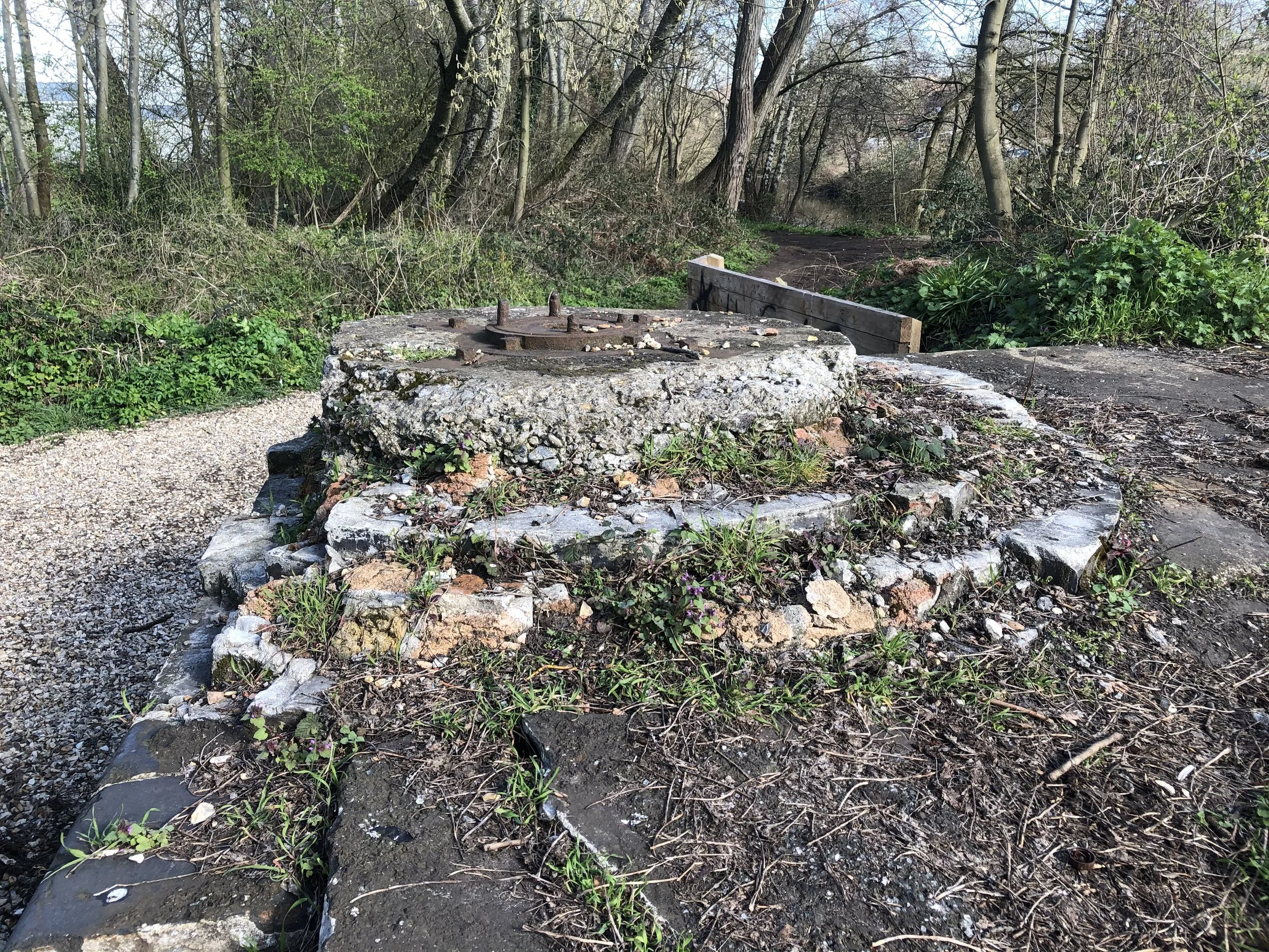
Close to the bay platform, I discovered an old structure that appeared to maybe have been a signal support from the railway.
According to the information board on the Marriotts Way walk, the engine sheds where this old relic was discovered were in close proximity to a cooling tower, crane, and water tower.
"Please do not hesitate to contact me if you have any ideas or suggestions."
The Engine Sheds
During World War II, in April 1942, Norwich City suffered significant damage due to the Nazi raids. Both Norwich City Station and the engine sheds were heavily damaged and were beyond repair. Consequently, a new structure was built to replace the older engine shed. The newer structure was simpler, with just two roads and a flat roof without doors. It was constructed using steel and concrete. The original building was much larger, made of bricks and had a tiled roof.
In 2021, when I visited Norwich City Station, the engine shed's floor had been re-excavated by Friends of Norwich City Station.
Leaving Norwich City station
After passing the engine sheds of Norwich City, we arrive at the location where the Wensum bridge once stood. This spot is where the first of three Victorian A-frame bridges once stood. The original bridge was removed in the 1970s, and a new footpath/cycleway bridge was constructed in 2002 to span the river Wensum.
The contractor Wilkinson & Jarvis constructed the A-frame bridges. William Marriott received his training and first job with the same company, which also played a significant role in building the infrastructure of the M&GN railway. Currently, two bridges remain, one in a well-preserved condition at Hellesdon and the other just outside Drayton.
The Wensum Dipper story
In November 1846, a steam train departed from Norwich and was en route to Melton Constable on a misty morning. However, a mistake in the yard caused the train to be sent down a siding off the main line and towards a set of buffers. Despite the driver's last-minute realisation of the error and application of the brakes, the train still crashed and went down the bank towards the river Wensum. Fortunately, the crew managed to escape unharmed and walked back to the goods yard. The next day, they were expected to return to work. This story was found on the information board, and thanks were given to Marriott's Way Heritage Trail and Norfolk County Council for providing the information.
Here is a photo of the new Wensum River crossing taken in 2021. The previous A-frame bridge has been replaced, and the current one has no railway connection.
“First road crossing bridge”
After the river Wensum bridge, the line kept curving to the right before reaching this road bridge, where the line then goes on a straight trajectory heading towards Hellesdon.
This is the A1024 mile crossroad bridge that carries the road overhead, and the railway runs underneath.
“First mile marker”
Marriott's way walk has many old mile markers from old railway parts along its route.
Here we see the first one after leaving Norwich.
Leaving the first-mile marker behind we head off down the old track bed.
“Second road crossing bridge”
On the Marriotts Way walk, the next bridge is Sweetbriar Road A140. Similar to the Mile Cross Road bridge, this one carried the railway underneath while the road went over the top.
The railway continued for a short distance before reaching the next bridge, located 0.4 miles away, which was one of the highlights of the walk - the Iron Bridge.

M&gn Bridge 249 The Iron Bridge
As we continue our walk, we will reach one of the most exciting spots on this trail - the second iron bridge that was once a part of the M&gn line. Unfortunately, the first bridge was removed, as you can see in the pictures above. This is the first original river crossing bridge that you will come across on the Marriotts Way walk. The bridge number is 249, and it has been beautifully restored with the help of the National Lottery Heritage Fund. You can find the exact location of the bridge with the help of Google Maps below.
“Second mile marker”
After we crossed the iron bridge and before the Hellesdon road crossing, we came to the second-mile marker, as seen below.
Hellesdon Road Crossing
After passing the second mile marker and just before reaching Hellesdon station, we need to cross over Hellesdon Road. It looks like there used to be a railway bridge at this location, but sadly it has been demolished due to changes in the road layout. When I visited the site in 2021, there was no trace of the road bridge left. I am grateful to the National Library of Scotland for their help.

Hellesdon Station
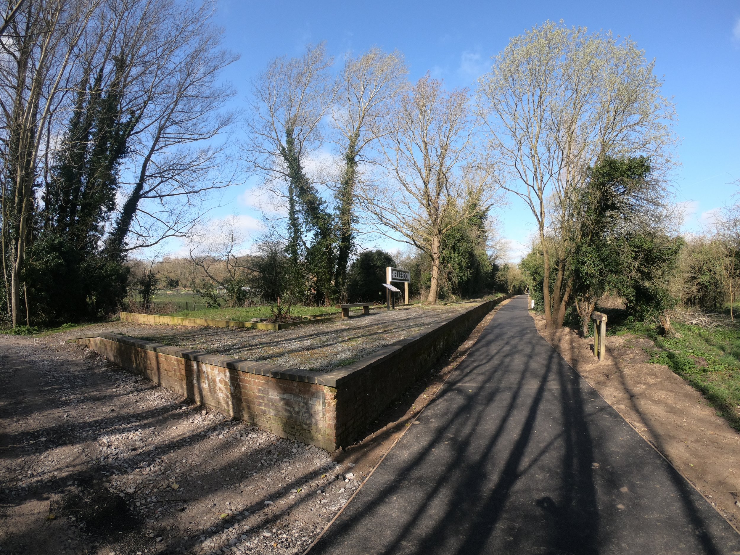
Hellesdon Station opened in 1882, along with the rest of the line. It was closed to passengers in 1952 and completely shut down in 1964. The station building was demolished in 1975.
In October 2010, the amateur group "Friends of Norwich City Station" cleared the platform wall.
Hellesdon was the first stop after Norwich City Station, 2¼ miles away. The station had only one platform with a slight curve before continuing toward Drayton.
These photographs of Hellesdon Station were taken in 2021.
If any members of the Friends of Norwich City Station are reading this, please accept my heartfelt thanks for all you have done.
Historic maps below show Hellesdon station
©National library of Scotland
Hellesdon station Photographed in 2021
Just after Hellesdon Station, I found this concrete block and I am unsure if this was railway-related.
After leaving Hellesdon station, we continue our journey towards the next and final station of this Marriott's Way walk segment: Drayton.
Before we arrive in Drayton, there are a few more railway remnants to explore, including several bridges and mile markers. So off we go! As shown in the picture below, we pass through this cutting after Hellesdon before reaching the next river crossing bridge.
Next, we arrive at a small bridge crossing the Tud River, which branches off from the Wensum River.
We're heading down Marriott Way towards Drayton again, close to the third-mile marker.
Mile marker number Three.
After the third mile marker, the old railway line continues through the countryside and, in places, alongside the River Wensum.
Just off to the side of Marriott's Way, there is a small picnic area under the trees, a lovely spot to take a well-earned short rest.
Off to Drayton once again here the old line opens up a bit into more open fields here for a short while up to the 4th-mile marker on Marriotts’s way.
Some remnants of old railways remain from days long past.
Mile marker number 4
The last mile marker before we reach Drayton.
Some old railway fencing is between mile marker number 4 and Drayton.
Railway crossing bridge
On our way to Drayton, we encountered a small railway bridge that crosses what appears to be a farm track. Unfortunately, like many others, this bridge has been covered in graffiti, much of which features offensive language.
The view from the top of the railway crossing bridge.
The view from the bottom of the railway crossing bridge.
Afterwards, we continue our journey to Drayton,just a short distance away. Before we arrive in Drayton, we encounter the final River Wensum bridge and the second iron A-frame bridge that still stands.
Originally, there were three bridges from the line's pre-closure days.
Although this bridge is not in as good condition as the first one when photographed in 2021, it still appears structurally sound and looks fantastic.

Bridge 254-A frame bridge
The final A frame bridge along the line before we reach Drayton.
Bridge 254 sign.
The final A-frame bridge.
View of the river Wensum from the top of the bridge.
The view from the bottom of the A-frame bridge.
I managed to make my way down to the base without slipping or falling. To be honest, it wasn't the easiest place to access, so if you decide to venture down, please take care.
Just after the final A-frame bridge, we come to the end of this first part of the walk along this old railway line now called Marriotts way.

Drayton Station
Drayton station was the second station on the M&GN Norwich City to Melton Constable line.
It opened on December 2, 1882, under the name Costessey and Drayton. On February 1, 1883, it was renamed Drayton. In 1903, it underwent another name change, becoming Drayton for Costessey.
The last train departed from Drayton on March 2, 1959, marking the end of its service.
Drayton station featured two platforms and a small goods yard.
By 2021, no trace of the old station remained, as it had been demolished long ago, and the land was replaced by industrial units and housing. A look at Google Maps reveals that the houses and industrial units now occupy the area where the railway and goods yard once stood.
Past & Present map coverage.
A memorial post for the old Drayton station is situated just beyond where the station once was.
Here we see Station Road at Drayton.
Here there is no trace at all left of any railway station or any remains of the old platforms or goods yard in 2021
Thanks for looking please click the links below for dedicated pages from Melton Constable and Whitwell & Reepham.


